As communities across the country continue to recover from Hurricane Ida and its remnant rains, we look back at the last I-named storm to wreak havoc on our region: Tropical Storm Irene.
Ten years ago, Tropical Storm Irene turned a late August weekend into a disaster of historic proportions. Communities from central New York to Vermont, New Hampshire, Connecticut, and Massachusetts suffered 100- or even 500-year-flood events as Irene rolled through the northeast.
Irene came at a time when public awareness of climate change and its real-world impacts was starting to go mainstream. No longer was climate change a theoretical, global phenomenon. It was beginning to hit here at home.
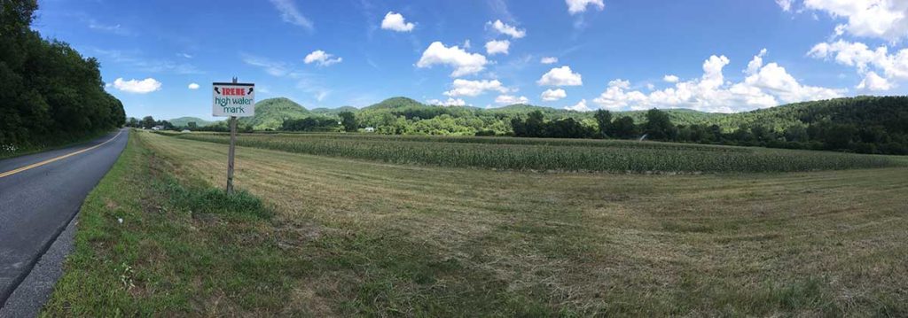
The storm struck Vermont hard. As many as eight inches of rain fell in twelve hours, with much of the state getting five to seven inches. The state’s naturally thin soils – made worse by years of timber harvesting and overgrazing – couldn’t absorb the water fast enough. The steep slopes of Vermont’s mountains and hills concentrated all that rainfall like a funnel, turning tiny brooks into raging torrents of whitewater.
Larger rivers, like the White River in the east or the Winooski River to the north, rose well above flood stage in a matter of hours, overflowing their banks and causing widespread destruction at a scale that many Vermonters had never seen before.
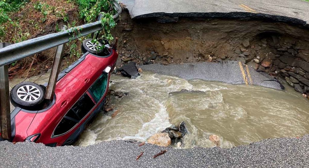
Hundreds of houses and buildings were swept away by the powerful floodwaters. Over 2,000 roads, including 500-plus miles of state highways, washed out. More than 300 bridges were damaged or destroyed, leaving 13 towns isolated and inaccessible by vehicle. At least seven people lost their lives.
The storm caused over $730 million in total estimated damage. But the dollars don’t measure the full impact to residents, businesses, and government. Families were displaced. Businesses were disrupted, relocated, or completely discontinued. Town facilities had to be moved to higher ground. Historic structures were destroyed. Even cemeteries and the human remains buried therein were lost.
Irene also had important ecological impacts. Stream surveys conducted before and after the storm showed that wild trout populations declined by 30 to 58%. Lake Champlain and other flooded Vermont lakes suffered widespread shore erosion and severe sediment loading from the floodwaters.
Ten years later, Vermonters have largely recovered from Irene but, of course, they have not forgotten. Now, with climate change making dry spells longer and even everyday storms more intense, what lessons can we take from Irene and Vermont’s recovery as we all learn to live with the impacts of our changing climate?
Unprecedented But Not Unexpected
The intensity of Irene was unlike previous storms, but destruction from a tropical storm reaching Vermont was not entirely unexpected. Vermont experiences flooding somewhere in the state almost every year. Major floods occur every 25 years or so. For decades leading up to Irene, climate experts were predicting more frequent and more destructive storms. That August day ten years ago seemed to prove those predictions true.
And yet, even today, the Great Vermont Flood of 1927 still stands as the worst disaster in Vermont history, when ten inches of rain fell during a 36-hour period. The flood killed 84 people, including Vermont’s Lieutenant Governor. Dozens of towns and villages were flooded as over 1,200 bridges and countless homes and roads were destroyed. Other storms, including the Hurricane of 1938 and an intense storm in 1973, took similar tolls, forcing rivers to record-high levels and destroying highways, roads, bridges, and homes.
What Was Different About Tropical Storm Irene?
The destruction from Irene occurred after an extended period of population growth and development in Vermont after World War II. The state’s population increased by 65% from 1950 to 2010. Despite zoning ordinances adopted in the 1970s and 1980s, many homes were built or expanded in floodplains. Bit by bit, development encroached on wetlands and small streams. Rivers were disconnected from their floodplains. Acres of pavement and rooftops and driveways pushed stormwater runoff downhill much faster. All this development in the river valleys contributed to both Irene’s flooding and the amount of destruction that it caused.
The impacts of climate change have become even more noticeable since Irene struck. Including Irene, Vermont had 18 federally declared disasters from 2007 to 2016, almost twice as many as during the preceding ten years. Most of these disasters resulted from severe storms and flooding.
Vermont now experiences more frequent, intense storms than it did just 30 years ago. According to the state’s Department of Health, annual precipitation has increased by seven inches since 1965, and the number of days per year with precipitation of one inch or more has nearly doubled. The winter snowpack melts two weeks earlier in the spring and freeze-up comes a week later.
Climate scientists expect these trends to continue. More frequent and intense rainfall events, sometimes localized, increase the risk of flooding, damage to infrastructure and buildings, water contamination, crop loss, wind damage, and power outages.
Tropical Storm Irene jolted a new generation of Vermonters, and thousands of new residents, into a full appreciation of the state’s ongoing vulnerability to climate change and future floods.

2021: A Wet Reminder
The summer of 2021 has been an unwelcome reminder of Tropical Storm Irene. Week after week, rivers rose quickly as heavy rainstorms passed through the Green Mountains at least a dozen times in June and July – and then again with Tropical Storm Henri in August, which had far less impact than was feared.
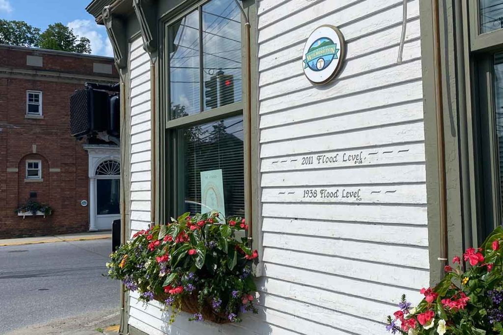
In mid-July, a line of thunderstorms flooded the streets in Wilmington above the curbs. The Deerfield River came up quickly, but the storm was short-lived and before long the river was running clear again.
“When I saw the streets flooding and the river coming up, I had a flashback to the trauma of Irene,” Gretchen Havreluck, a Wilmington town employee, said. “We know how fast the Deerfield River can come up and how high it can get. I was worried.”
In another July storm, about a month’s worth of rain fell in Bennington and Windham counties in just a few hours, causing large-scale washouts. The wet summer was the talk of the town across southern Vermont, a soggy nod to the power of water. It has people wondering if this pattern of regular heavy storms is the new norm. Climate science suggests that yes, it is.
Climatologists predict that a warming climate will work at both ends of the spectrum: extended periods of drought offset by concentrated cycles of wet weather. With an increase of one or two degrees (F) in annual temperature, the atmosphere will build heat domes that dominate the weather for weeks at a time. The atmosphere can also hold more moisture, so when it rains, it pours. Hurricanes are expected to be more frequent and more powerful – and more likely to cause damage as far north as northern New England.

Vermont’s Climate Action Plan
In response to these worrisome changes, Vermont enacted the Global Warmings Solutions Act in September 2020. The Solutions Act elevated Vermont’s goals for cutting its climate-damaging emissions into requirements. It also established a Climate Council to develop a Climate Action Plan by December 2021 to meet those emissions mandates economy-wide.
The law calls for net-zero emissions by 2050. And it encourages smart growth and related strategies to lower energy burdens for rural and marginalized communities while encouraging climate adaptation and resilience of both built and natural systems.
As the Council does its work, CLF has been advocating ambitious actions to maximize the impact of the Climate Action Plan. Zack Porter, CLF’s Lake Champlain Lakekeeper, says that “the Climate Action Plan is the best opportunity for this generation to shape policy for a climate-resilient Vermont. Rarely do we have the chance to rethink the status quo and adopt a holistic approach that can tackle climate change head-on, while also having other important environmental benefits such as cleaner water, cleaner air, and reduced hazards from flooding.”
Boosting Resiliency
With climate change causing more frequent, intense storms, the risk of a serious flood (their frequency and magnitude) will continue to increase for some time. But, as Zack Porter points out, with proper planning, appropriate land use, and well-designed buildings and infrastructure, the hazard – the potential harms – from those floods does not have to increase.
The Climate Action Plan will include strategies for expanding carbon sequestration and storage in Vermont’s natural and working lands, soils, and waters. This means maintaining intact, structurally complex forests and wetlands that are most effective at retaining and slowing precipitation and recharging groundwater.
CLF has argued that the Climate Action Plan should encourage restoring wetlands and buying out marginal farmland to restore the wetland functions that reduce flooding hazards. In addition, CLF has encouraged expanding property buy-out programs in flood-prone areas to create open space and provide flood attenuation, as was done in many towns following Tropical Storm Irene using federal and state funds. These land improvement strategies should be backed with acreage targets and milestones to monitor progress.
Towns also must do more to shape land use and development that support landscape-scale carbon sequestration and storage, climate resilience and adaptation, and natural and human communities for a sustainable and equitable future.

Ready for Future Floods?
Even before the Solutions Act was enacted, the Vermont Agency of Natural Resources (ANR) and its partners launched the website www.floodready.vermont.gov to provide information for the public about the risks of flooding and strategies for making communities more flood resilient. Vermont’s River Management Program has been working to raise understanding of river processes that promote long-term river equilibrium (stability) and sustain quality habitat. Vermont ANR has dedicated considerable resources to training municipal officials to assess their vulnerability to future floods, protect public infrastructure, and better respond to flood emergencies in ways that respect and protect river dynamics and aquatic habitat.
During a flooding event, water level is a major concern, but in Vermont, the bigger hazard is damage to property and public infrastructure from erosion (both horizontal and vertical) and deposition caused by the power of moving water.
Since Irene, some strategies being employed for mitigation of those hazards include:
- elevating or removing buildings (using relocation or buyouts) from the highest risk areas (25- or 50-year flood zone);
- sizing culverts, stream and river crossings, and other potential obstructions to reduce ponding, including from debris dams or ice dams;
- constructing flood-resistant foundations that allow floodwaters to flow through.
In its work to help shape Vermont’s Climate Action Plan, CLF continues to emphasize the need for nature-based, restorative strategies:
- connecting rivers and streams to their natural floodplains (i.e., let floodplains flood) and protect floodplains and wetlands from development;
- allowing rivers and streams to meander within the river corridor;
- promoting zoning, subdivision rules, and building codes to create buffers, protect alluvial and headwater forests, encourage on-site stormwater storage and infiltration, and discourage further development in flood-prone areas;
- increasing forest cover and naturally uneven ground in a watershed by incentivizing forested buffers, expanding municipal tree planting and forests, reducing roadside mowing, incentivizing agroforestry, and expanding protections for wetlands.
And finally, any instream work to restore or alter river channels or repair washed out roads and culverts must follow Vermont’s new stream alteration rules and performance standards to protect aquatic life and habitat, prevent the creation of unintended flood hazards, and protect the rights of neighboring landowners.
Local Solutions to Climate Change Impacts Are Key
Vermont took the lessons learned from Tropical Storm Irene very seriously. Now, ten years later, the state legislature is taking climate change just as seriously. The planning for increasingly intense future storms requires action from the local level up to the state and regional levels, plus strong advocacy at the federal level.
Vermont’s Climate Action Plan should be at the forefront of those efforts.
After a long career as an environmental professional in government, business, and consulting, CLF Senior Fellow David Van Wie is now a writer and photographer and teaches a graduate class in environmental journalism at Dartmouth College. David’s newest book is called Storied Waters: 35 Fabled Fly Fishing Destinations and the Writers and Artists Who Made Them. David writes a monthly column for The Maine Sportsman called “The Sporting Environment.” His writing has also appeared in Northern Woodlands magazine, The Maine Sunday Telegram, Dartmouth Alumni Magazine, and The American Fly Fisher.

